ALTON - The temperatures are going to rise over the next few days after a terrible chill throughout the area Wednesday evening and Thursday morning.
Get The Latest News!
Don't miss our top stories and need-to-know news everyday in your inbox.
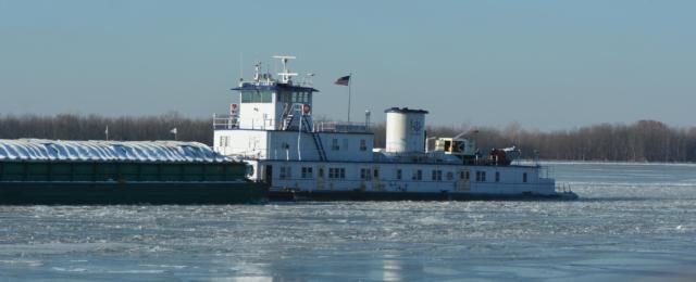
Several schools were cancelled today because of the Wind Chill Advisory, which has been lifted by the National Weather Service in St. Louis. Ice was forming on the Mississippi River near Alton, but that should subside as the temps warm over the weekend.
The forecast is as follows: temps will drop to 6 degrees by 9 p.m. tonight in the Metro East area, then rise to 19 degrees as a high Friday and a low of zero degrees. Saturday it will be even warmer at 22 degrees with a low of 18 degrees, then Sunday the temperature is projected to rise to 38 degrees and low of 31 degrees, with some precipitation in the forecast.
A winter mix of precipitation is expected to develop Sunday morning which could cause hazardous driving conditions. Temperatures are forecast to warm above freezing during the afternoon which will change the mix to rain. Unfortunately, the ground is very frozen from the last two weeks and therefore the rain may continue to freeze on untreated roads, sidewalks, etc. into the afternoon hours.